Drought Indicators
A Drought index is the computed numerical representations of drought severity, assessed using climatic or hydrometeorological inputs, including precipitation, temperature, streamflow, groundwater and reservoir levels, soil moisture and snowpack. They aim to measure the qualitative status of drought on the landscape for a given time period. Indices are technically indicators as well
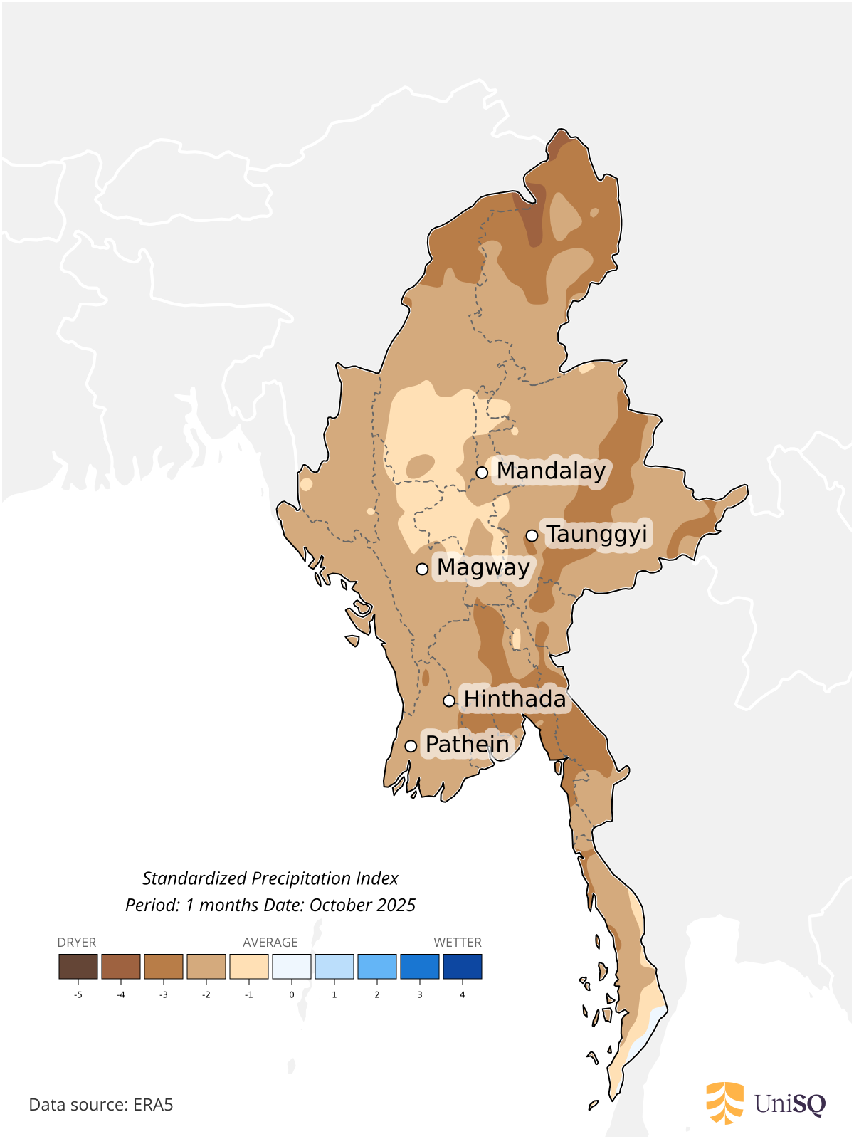
Standardized Precipitation Index
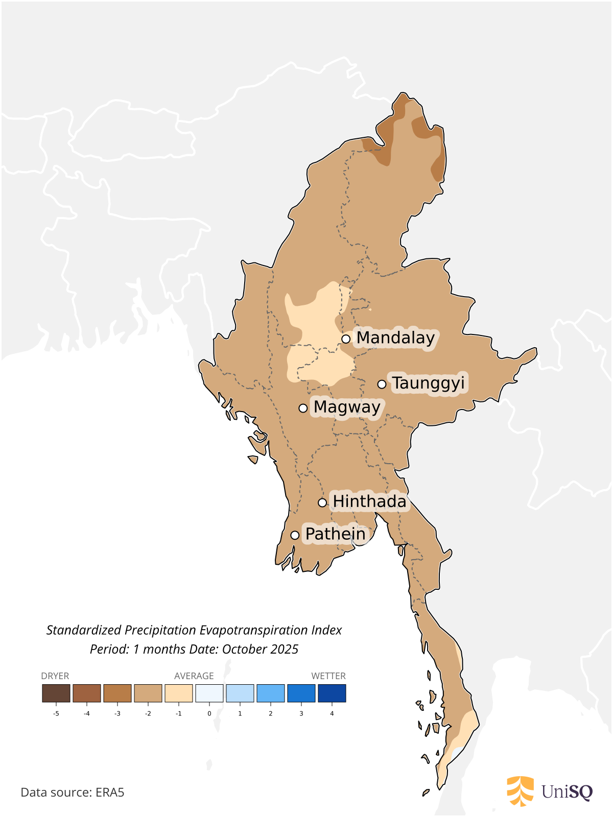
Standardized Precipitation Evapotranspiration Index
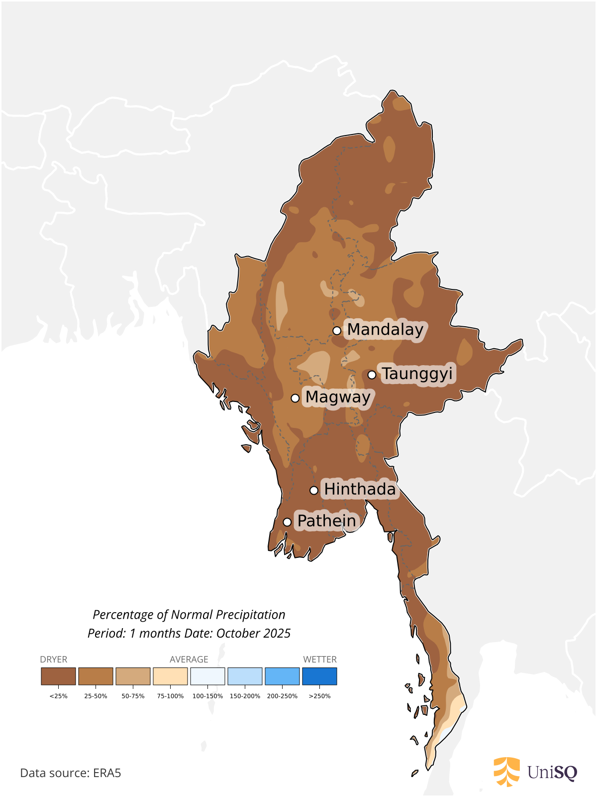
Percentage of Normal Precipitation
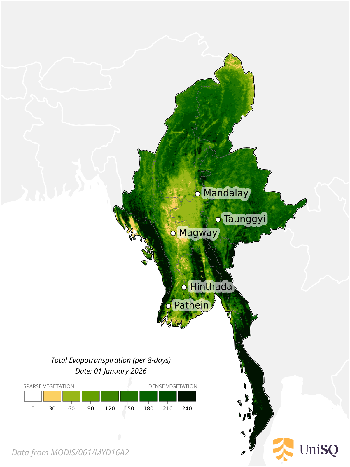
Total evapotranspiration
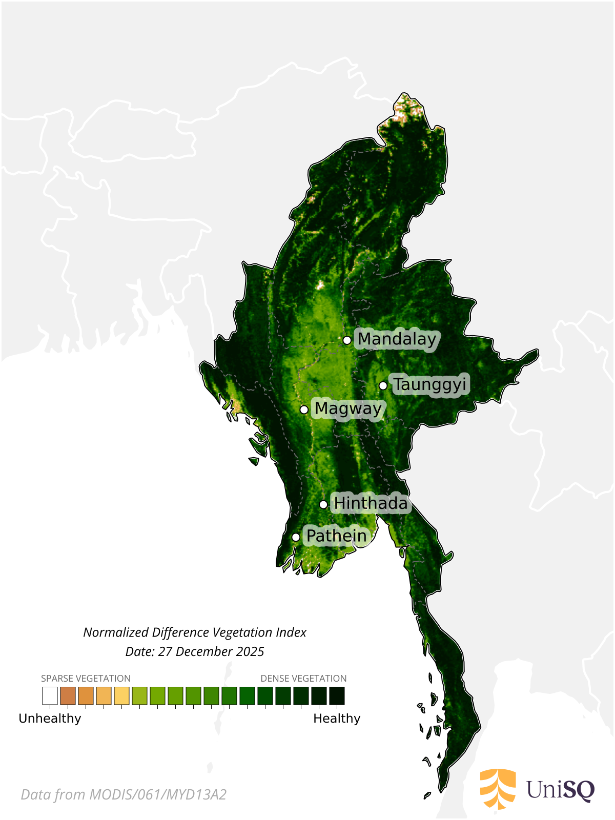
Normalized Difference Vegetation Index
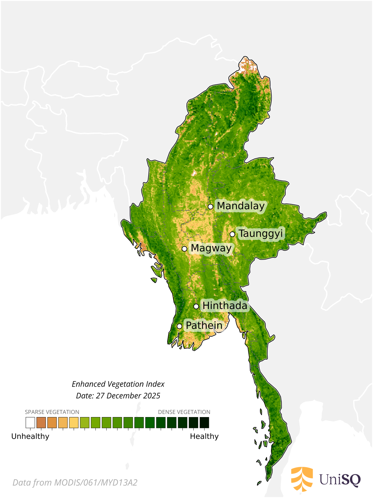
Enhanced Vegetation Index
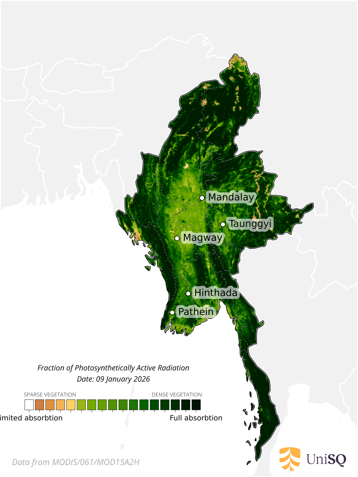
Fraction of Photosynthetically Active Radiation
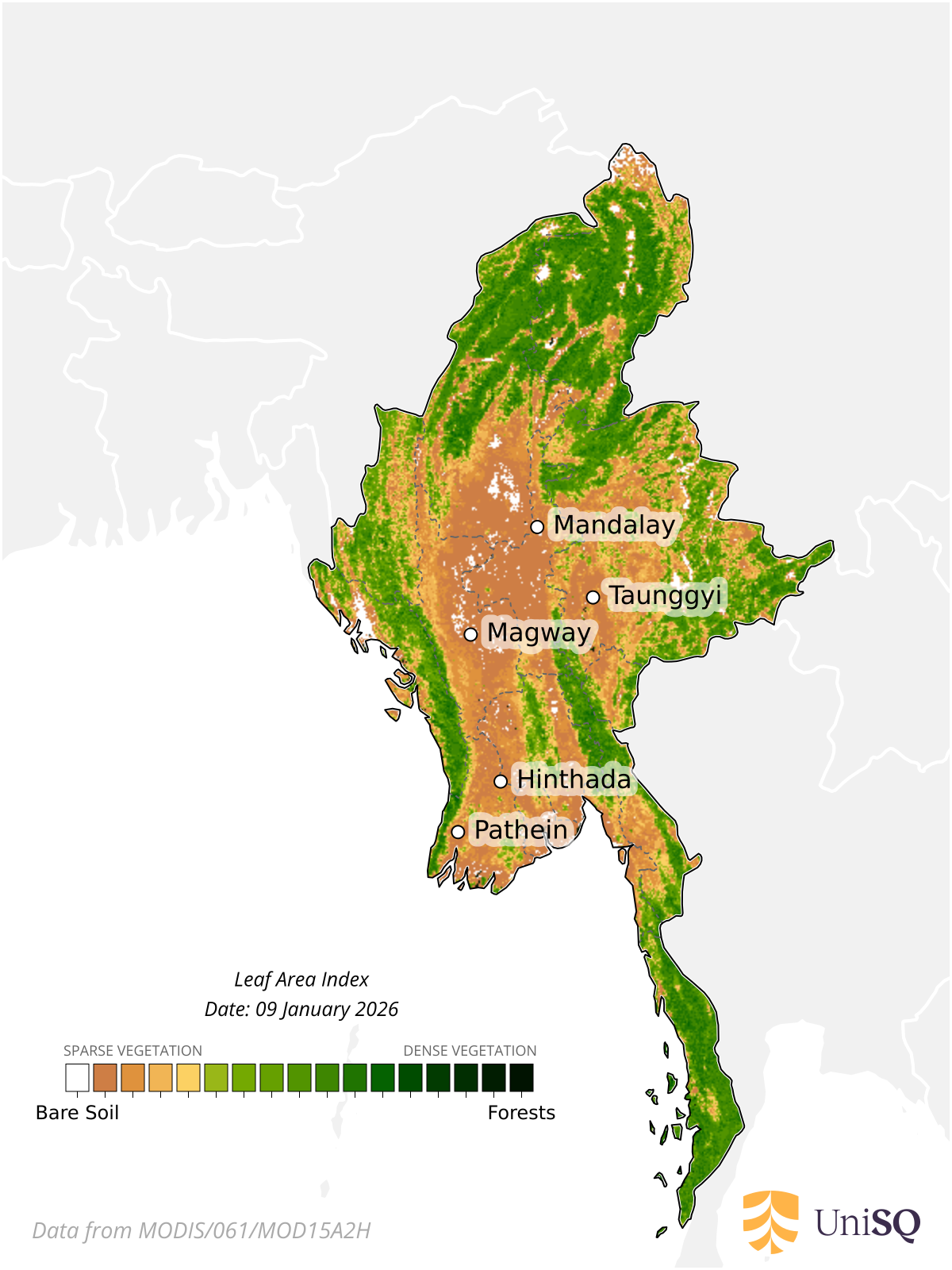
Leaf Area Index
For a Blended version of the Australian Combined Drought Indicator, as well as other drought indices, please visit the Northern Australia Climate Program
Why so many Indices ?
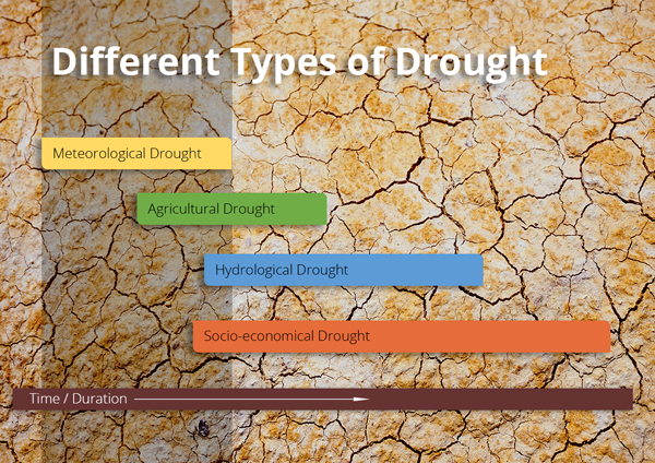
"When drought is described only in terms of lower than expected rainfall, it is referred to as a meteorological drought. Other names for drought are related to their impact. These include agricultural, hydrological, and socio-economic
drought. The common feature is that impacts often persist long after a meteorological drought has ended - i.e. when it starts to rain again. The distinction between the various droughts, while clear to water professionals and those
directly affected, is not always so clear to the public."
For more information regarding Drought please visit the Integrated Drought Management Program